
Walk a Waterloo Street Record Trail
The strongest street directory result builds from place to record. Start with the complete service address and preserve its city spelling. Move to the mapped parcel, then compare the county's tax and recorded-instrument systems. Voter information is purpose-limited and should only verify known details. For a past household, use an edition of a city directory rather than treating today's parcel record as history.
- Confirm the full street address and current status in Waterloo Address Points.
- Open the tax-parcel representation and note the parcel identifier and legal description.
- Use the Black Hawk Treasurer form with number and street name, without the street suffix.
- Follow a known owner into AVA or Iowa Land Records for deeds and related instruments.
- Check permits by service address, then use historical directories for earlier household clues.
This flow is address → point → parcel → owner clue → deed chain → dated household evidence. It avoids assuming that ownership equals occupancy.
Read Waterloo Street Point Fields
Waterloo City Engineering maintains an address layer for buildings and utility structures. Its display field is FULLADDR. Other fields include address number, full street name, municipality, ZIP, postal community, unincorporated community, latitude, longitude, point type, and status. The local quirk is important: POINTTYPE can describe a House, Utility Asset, or another feature, while STATUS can be Current, Pending, Temporary, Retired, or Other.
| Waterloo field | Type | Use and limit |
|---|---|---|
| where | REST query | Required query expression; use a precise street condition |
| outFields | Selected output | Request only address, status, type, ZIP, and municipality fields needed |
| geometry | Optional spatial filter | Narrows a visible block or area |
| resultRecordCount | Pagination | Service maximum is 1,000 records |
| format | Output control | JSON, GeoJSON, or PBF is available |
The official Waterloo Address Points service shows the source.
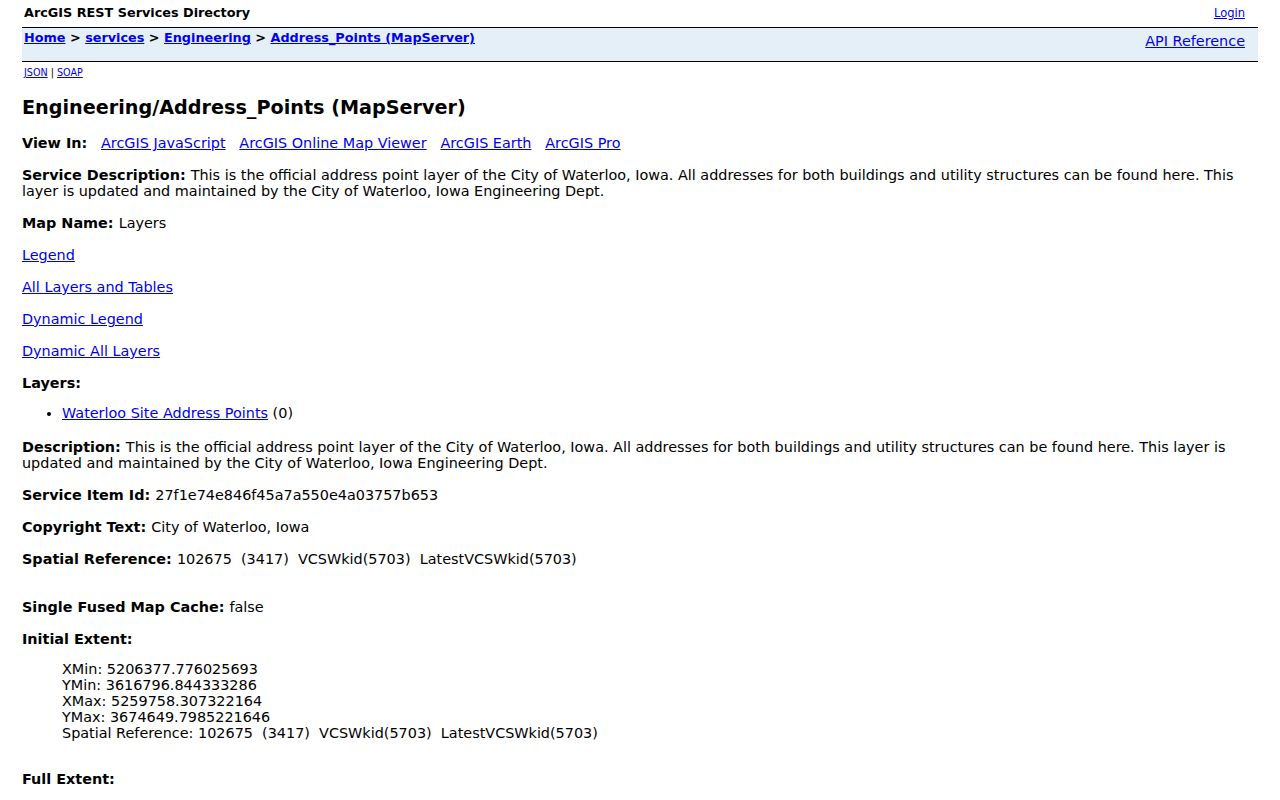
A current House point is a better starting location than a retired or utility point, but none of these fields names an occupant.
Waterloo Street Directory Record Coverage
Address-keyed sources overlap without duplicating each other. The city defines the location and publishes parcel representations. County offices retain assessment, tax, and recorded-document roles. Waterloo eSuite adds a building-work trail by service address. Historical directory editions can supply past householder clues, but no verified standalone reverse-directory run was found.
| Record set | Keeper | Street fact | Access |
|---|---|---|---|
| Address Points | Waterloo Engineering | Address, municipality, point type, status, ZIP | Free REST query |
| Tax parcels | City layer / county source systems | Parcel geometry and legal field | Free REST layer |
| Assessment mapping | Black Hawk Assessor | Assessment and property context | Beacon handoff or office |
| Tax parcel search | Black Hawk Treasurer | Owner, parcel, receipt, or street-address route | Public lookup |
| Recorded instruments | Black Hawk Recorder | Deeds, mortgages, releases, liens, plats | AVA, ILR, counter |
| Permits | City of Waterloo | Permit trail by service address | Public eSuite form |
Use the parcel identifier and legal description to bridge systems. Keep each access date because map, tax, permit, and deed records can update on different schedules.
Waterloo Parcels Are Not Surveys
The City tax-parcel service is a published representation of real-property areas combined with assessment and tax information. It supports queries and JSON, GeoJSON, or PBF output. Black Hawk County's mapping page sends users to Beacon and warns that the map is not a survey. It compiles records, plats, surveys, deeds, and contracts for government use without a warranty. Critical boundaries require independent confirmation.
Open the Waterloo tax-parcel layer after the address check.
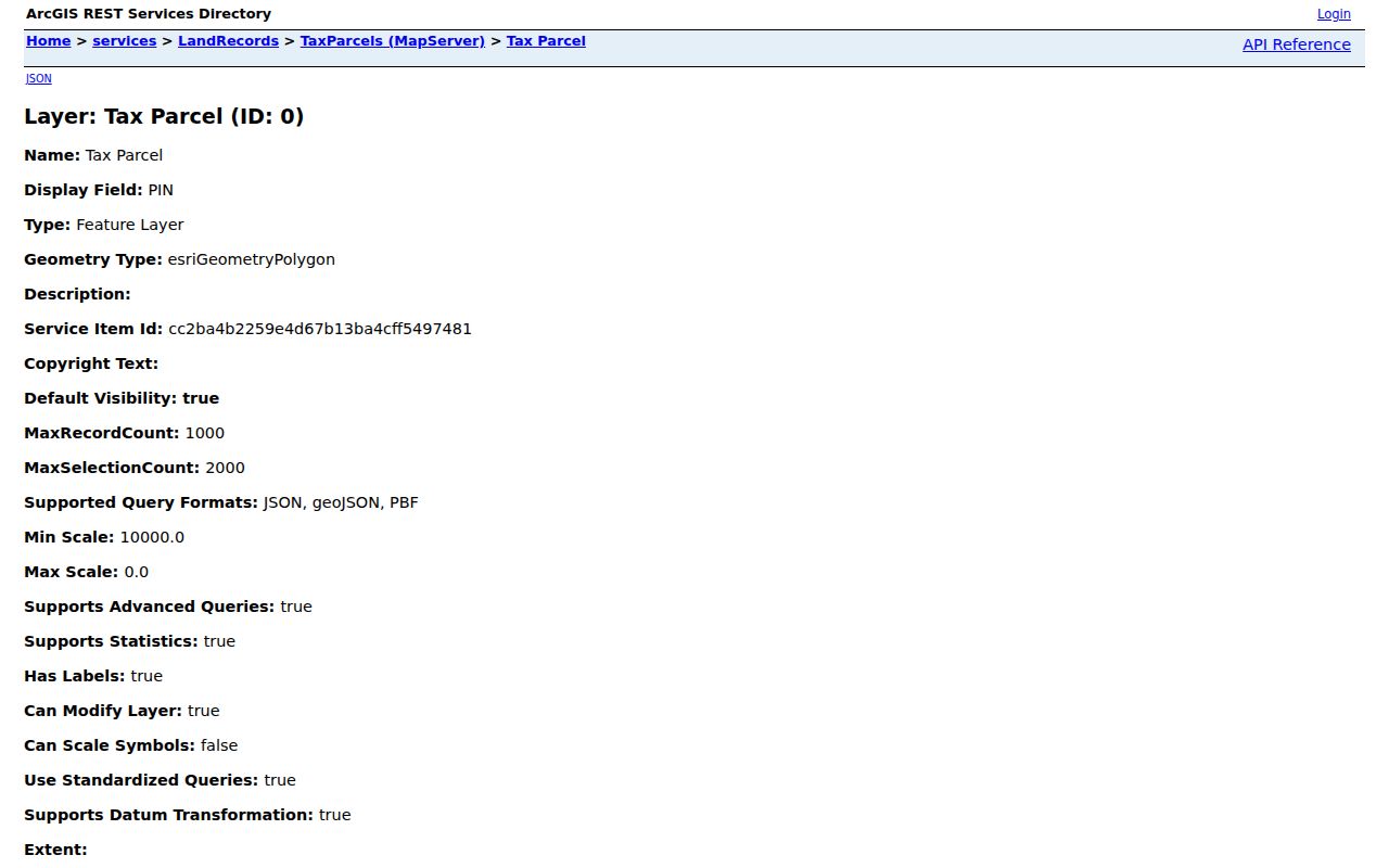
The polygon places a parcel along the street. A deed image or certified record must come from the Recorder or Iowa Land Records.
The county's Real Estate Mapping handoff explains the office split.
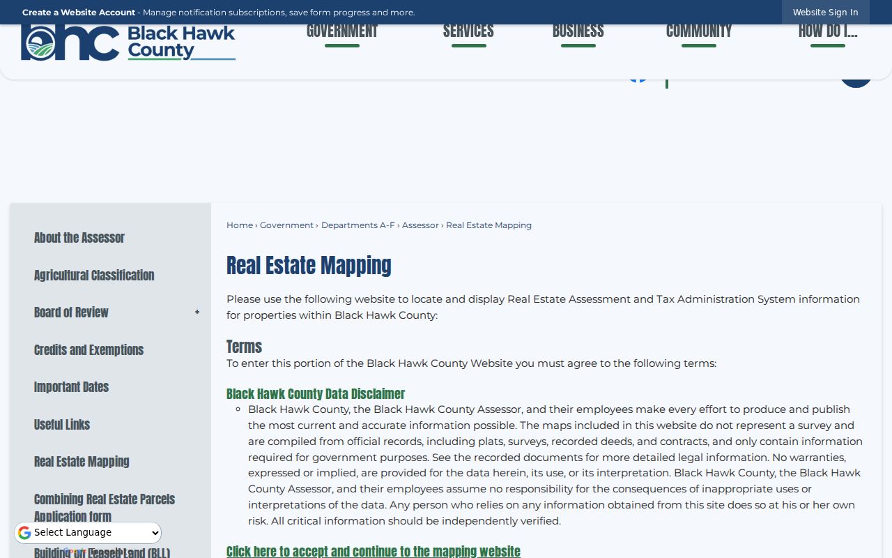
Assessment questions go to the Assessor, tax calculations to the Auditor, installments to the Treasurer, transfers to the Recorder, and spatial-layer questions to GIS staff.
Search Waterloo Streets in Tax Records
The Iowa Treasurers form for Black Hawk County accepts one search mode at a time. Choose Owner Name, Parcel Number, Receipt Number, or Property Street Address. Parcel mode accepts as many as ten identifiers, one per line. Address mode uses only the street number and name, such as “123 Main,” rather than “123 Main Street.” Black Hawk is county ID 7. Lookup itself needs no account; payment and account functions are separate.
Use the official Black Hawk parcel search after normalizing the street.
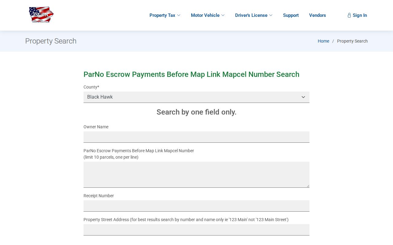
A result is a tax and parcel lead. Compare it with the Assessor and Recorder rather than reading a mailing name as a complete list of Waterloo residents.
Follow Waterloo Deeds by Address
A street address usually does not go straight into the statewide deed search. First capture the current owner clue, parcel number, and legal description from property sources. Then search Black Hawk County in Iowa Land Records by grantor or grantee, dates, and document type. A grantor transfers an interest; a grantee receives one. Advanced search can add book, page, document ID, property information, or parcel ID when indexed.
The Black Hawk Recorder also keeps AVA and provides in-person help at 316 E 5th Street, Room 208. Its online earliest year was not posted. Older street research can move to State Historical Society town-lot deeds from 1855 to 1901, land deeds from 1853 to 1902, Auditor land transfers from 1866 to 1988, and town-lot transfers from 1880 to 1988. These series require separate searches. Do not merge a city lot and rural land trail merely because a modern street name looks similar.
Waterloo Permits by Service Address
Waterloo eSuite separates Contractor Access from Public Information Search. The public form exposes Permit Type, Permit Number, and Service Address. Coverage dates and the permit-type labels were not stated on the inspected screen, so the street directory should not promise a complete building history. A permit can still date work at a place and give the office a precise record to locate.
Try the Waterloo public permit search with the city-formatted address.
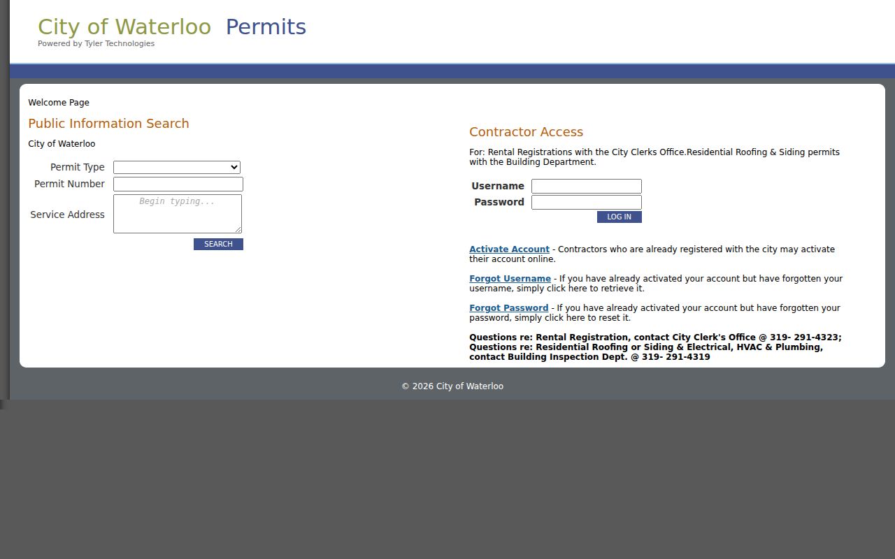
Registration questions route to the City Clerk at 319-291-4323; roofing and siding permit questions route to Building Inspection at 319-291-4319.
Waterloo Street Directory Terms
The same word can mean very different things across a map, deed, and directory. Define the terms before joining results.
- Parcel
- A mapped unit of land with an identifying number.
- Situs address
- The physical location of property, which can differ from the tax mailing address.
- Plat
- A recorded drawing that divides or describes land and lots.
- Legal description
- The formal land description used in recorded instruments.
- Criss-cross directory
- A historical directory arranged by address or street instead of only by surname.
Waterloo Public Library's 1873 to 1991 directories can help with older address clues. The historical collection is covered on the Waterloo city directory page rather than repeated here.
Waterloo Streets Cross Map Boundaries
The Cedar River bisects Waterloo northeast to southwest, placing core neighborhoods on both sides. A short-looking street search may cross river corridors, floodplain context, neighborhood boundaries, or postal areas. The City's 2018 human-readable map has a numbered grid, street names, and cemeteries, but it also states that it is not a survey. Pair that dated visual map with the live address layer.
Postal labels add another trap. Waterloo uses ZCTAs 50701, 50702, and 50703, yet its postal city reaches parts of Elk Run Heights, Hudson, and unincorporated Black Hawk County. Washburn can use 50702 without being legal Waterloo. Compare MUNICIPALITY, Post_Comm, ZIP, and the parcel jurisdiction before assigning a street result to the city.
Waterloo Street Directory Privacy Limits
An official address point establishes a place, not a resident. A parcel and deed may name an owner or deedholder, but neither identifies every person who stays there. Permit data shows work linked to a service address. Voter verification is governed by Iowa Code Chapter 48A, excludes sensitive identifiers, and cannot be treated as a free household roster. Utility customer data and other protected personal details were not found as public Waterloo street lists.
Publish the smallest fact needed. For neighborhood curiosity, show the official source and record date without building private profiles of adjacent households. An outdated tax name, retired address point, or old directory entry can otherwise create a false claim. Commercial neighbor tools often blend sources and dates without clear custody; official Waterloo rolls are narrower but easier to verify.
An online gap is not proof that no record exists. The Black Hawk Recorder offers a counter, phone contact, and public research services. Iowa Public Records Law also allows a request in person, by phone, in writing, or electronically unless a statute closes the item. Identify the existing record, office, date range, address, parcel, instrument, or permit number. State whether inspection or an electronic copy is preferred. An office need not create a street roster, do research, or answer a broad question. It may charge actual costs and review confidential fields. Recorder prices found in the research include uncertified copies at $1 per page, certification at $5, and a $2 email fee plus copy charges. Confirm current prices first. For old street work, ask WPL, Grout, or the State Historical Society for a named edition or series.
Lawful use. Use Waterloo street and address records only for lawful personal research, never to stalk, harass, intimidate, or harm anyone.